Nigeria is stepping up its game in geospatial technology to plan smart cities and modern infrastructure more effectively. This was the key message shared by the Surveyor-General of the Federation, Abdulganiyu Adebomehin, at a recent one-day workshop in Abuja. The event focused on using high-quality drone images and street-view data collected from parts of Abuja Municipal Area Council.
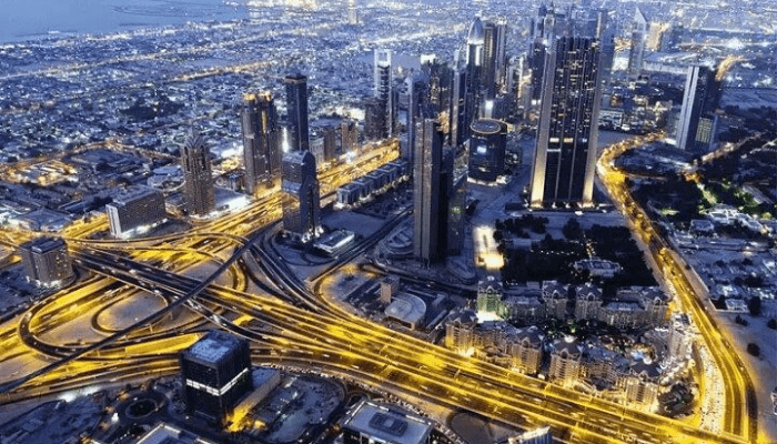
Adebomehin praised Nigeria’s progress in collecting and using digital maps and images. He explained that building smart cities is impossible without high-resolution images that show even the smallest details. “You can’t plan a smart city without clear images that show everything down to two centimeters,” he said.
He also revealed that the national mapping project is well underway. Out of 35 areas scheduled for data collection, 20 have already been completed. After a short pause, the project is set to resume with greater energy. “We’ve finished 20 blocks, five are left, and it’s time to move forward,” he added.
Adebomehin connected this mapping work to the government’s “Renewed Hope Agenda,” saying it supports the country’s larger goals. He pointed out that drone technology is not just used in battles but also helps in building roads, bridges, and cities. “Drone technology is powerful—if we don’t use it, we risk falling behind,” he warned.
He called the project a first-of-its-kind in Africa and pushed back at critics who doubt Nigeria’s tech progress. “If you don’t follow what’s new, you’ll be left out of the smart city plans,” he said.
The workshop also featured Azeez Olaniyi, head of the Photogrammetry and Remote Sensing Department. He spoke about digital twins—virtual models of real places—that help governments plan and manage cities better.
Olaniyi said digital twins are already used in places like South Korea to track airport traffic in real-time. “Some systems have only a 35-second delay, and we can use that here in Nigeria too,” he said.
He explained how this tech saves money and time. “If something needs repair, we don’t have to dig up the ground or inspect buildings. We can check everything in the virtual model first,” he said.
Olaniyi also shared how geospatial data helps in building roads, laying pipes, and extending power lines. Instead of sending surveyors to every location, planners can now work from a computer screen using digital maps.
He added that this tech can improve how Nigeria conducts its population census. By studying the shape and size of buildings, the government can estimate how many people live in each area—without sending teams to every home.
In terms of safety, Olaniyi said digital twins can predict what could happen during natural disasters like floods. “We can see which buildings might be at risk and take action before disaster strikes. This technology helps save lives and property,” he said.
This workshop showed how Nigeria’s investment in geospatial tools can make a big difference in building smarter cities, keeping people safe during disasters, improving public services, and boosting national security.


4 replies on “Nigeria Pushes Geospatial Technology to Build Smart Cities”
[…] Nigeria Pushes Geospatial Technology to Build Smart Cities […]
[…] innovator is offering free crypto training for Nigerians. Hanu Fejiro, a leading tech innovator in Nigeria, has launched a free training program focused on cryptocurrency, blockchain, and decentralized […]
[…] Tech Limited, a global manufacturer of car care products, has officially launched its operations in Nigeria. The company is known for producing high-quality vehicle maintenance solutions and is now bringing […]
[…] praised Oyinlola for pushing the limits of what technology can do, especially in making devices smaller and more […]